Creating a World Map for D&d
- 16.08.2019
- Nathan
Creating a world map can seem very daunting at first, but there are many different paths you can take depending on many factors. Before you move forward, take some time to figure out what you want from it and how much of your time and personal skill set you want to apply to it.
The following points should be considered:
- Do you want to create all aspects of your world’s geography or are you ok randomly generating something?
- Do you want to draw your own map, digitally or by hand?
- Do you want to plan many locations/geographical features beforehand or as you play and see where the story takes you?
For my first world map, I used the Terra Incognita website for randomly creating terrain, later adding my own continents and choosing an area to focus on. The great part of this site is the millions of unique terrains generated which you can zoom in on for more details. The site also generates a URL unique to the part of the map you view allowing you to go back in and grab more images for your use.
Inkarnate - For those who want to create a great looking map themselves, Inkarnate allows you to draw a map using brushes and stamps ready for you to annotate with your own locations. After signing up you can create a standard definition map for free, or pay for HD versions.
After you have an idea of the geography of your world you will need to lay out some key locations. You don’t have to stick to real-world vernaculars to do this, but it does help! As such you can start with choosing continents and countries/territories based on the landmass or geographical features that might logically divide people, such as mountains, valleys or seas. Next, think about where key/capital cities would be located. This gets a bit more complicated as you may want to think about why a city is where it is and what the make-up of its society looks like. You should consider the following:
- Do most of your cities sit on the coast or near large rivers? Most large societies set in a medieval setting grow large because of favourable trading routes and easy access to the people across large distances whether by river, natural quays or large roads.
- Some cities may live by valuable natural resources. That could be in a mountain, a cave network or fertile farmland.
- Think about what the cities freely have access to and what they would need to have imported from further afield. Now, these kinds of details really get you into the weeds of world design, but if that’s your thing, it's an important step.
The trade, resources and fabric of society that make a city are what forge alliances, enemies and lore between lands, cities and people in your world. If you can, let the geography of the world begin to tell it’s stories for you based on the points above.
Of course, all of this is great if you want to think through every part of the world, but for some, it’s way too much. There are some great tools out there for creating maps with locations, names and even lore ready for you to get going and add your own flavour to.
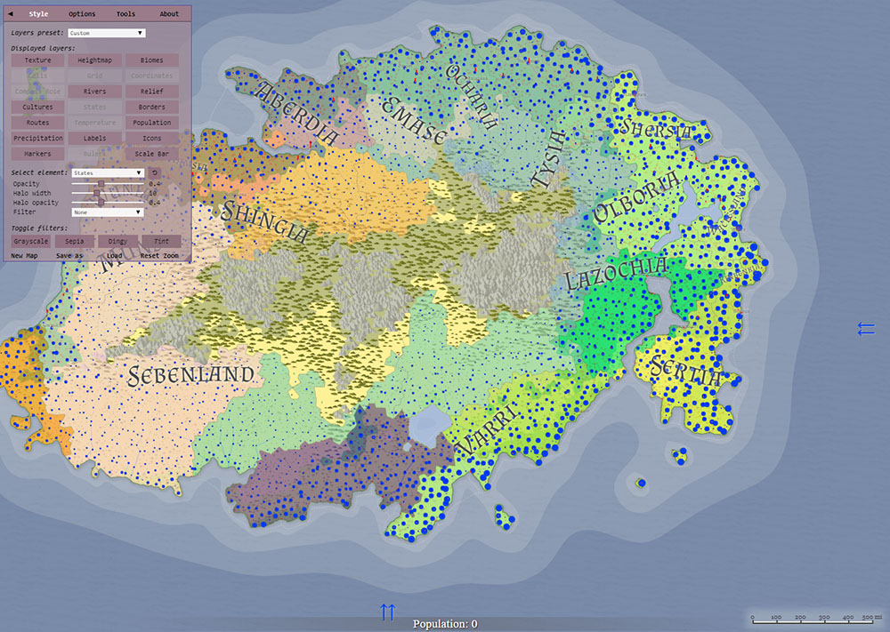
Azgaar’s Fantasy map generator - This fantastic resource can pretty much do it all. States, cities, roads, rivers, mountains. Even showing more advanced details climate, cultures, population and precipitation. This site does a lot of the heavy lifting and the maps look great, though it doesn’t allow you to change the layout of the land.
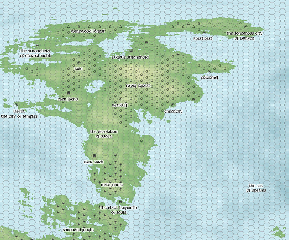
Donjon’s Fantasy World Generator - Though it may not be as detailed, Donjon’s world generator provides a beautifully utilitarian map, marking out each hex and what features you may find there. It also provides territories and lists of named castles, cities and ruins.
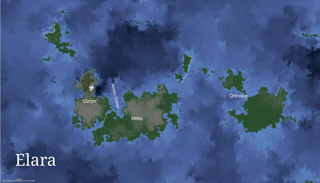
created the world of Elara. I named 3 continents (despite having more landmasses), Ozryn, Metis and Orthosie. My story took place on Ozryn with a brief expedition to Metis, a tropical jungle land. I initially focused my adventure on a coastline south of a large mountain before straying further afield. The adventure focused on the players’ desire to reach the plane of Celestia, which informed many decisions around the lore of the world. Including a huge mountain range that reaches heights beyond visibility and a capital city steeped in history related to the good-aligned plane of existence.
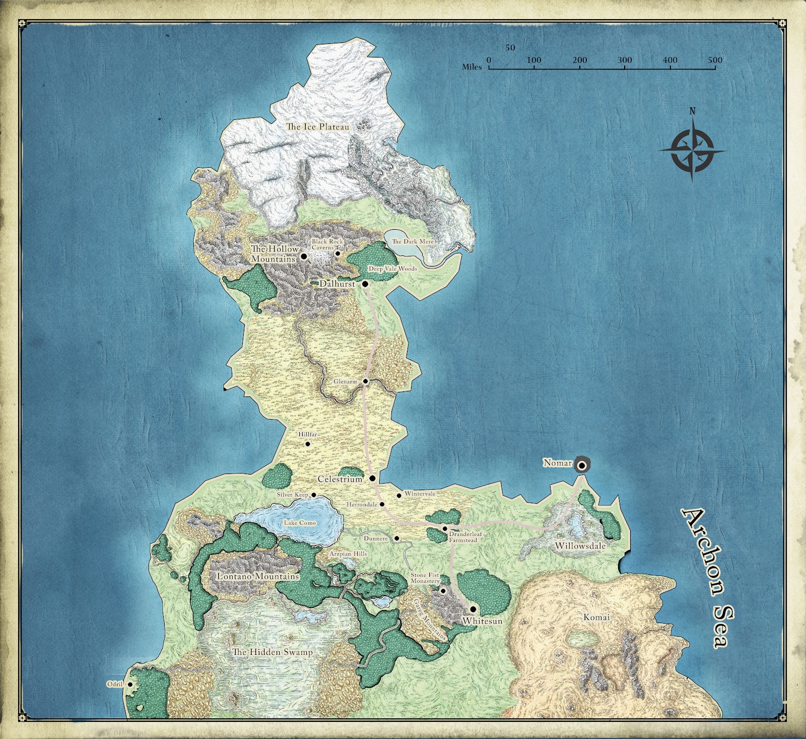
Players’ backstories may also inform many locations on your map, you may even let them name some towns and villages and add colour to the place they’re from. The Village of Whitesun was the hometown of a player who described his home as a lumber village surrounded by mountains.
I took the outline of a part of my world map into photoshop and sampled parts of the d&d Faerun map for creating terrain textures. If proficient with photoshop, there are many great resources to help with map building. Do a search for photoshop brushes, textures and other resources for drawing something truly personal.
Mike Schley created amazing maps, many of which are used in official d&d products. He also has tutorials for creating maps on his tutorial blog.
During my game, I was guilty of making my players jump from city to city and continent to continent during my first game as I wanted them to see everything. Don’t be afraid to run a more grounded game, holding back on everything you have created until it makes sense in the story. As such, I would recommend choosing a smaller, more manageable area to focus your stories on. Sure you can have an idea of what might inhabit the lands further afield but don’t be afraid to improvise this during play.
In the next post, I will revisit some of the towns and cities I created for my campaign. From creating/using maps to discovering their history, I will show what I have done and what can be improved upon for future stories.